Gatwick-Style Drone Chaos Could Happen Here, Absent FAA Clarity
- Aviation bill ended five-mile sensitive airspace restriction
- U.S. regulators haven’t created new rules for distance, access
At a time London’s Gatwick airport is shut down because of an unsafe drone incursion, there’s no clear definition in the U.S. of how close to an airport is too close for unmanned vehicles to fly.
While it’s illegal to fly drones within a mile of the approach and departure ends of a runway, the Federal Aviation Administration Authorization (Public Law 115-254) signed Oct. 5 immediately repealed a requirement that recreational operators notify air-traffic control when they want to fly within five miles of controlled airspace. Since then, the FAA hasn’t defined a safe distance for drones to fly in proximity to airports, with the exception of runway zones, nor implemented a new procedure for authorizing those flights.
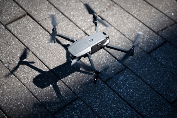
To complicate matters, the biggest maker of consumer drones has created a new GPS-based system that allows its products to fly closer to U.S. airports than in the past, even though some users have no way to get authorization to operate in that air space and don’t know where they are legally allowed to fly.
“There shouldn’t need to be a catastrophic event before the level of urgency is increased,” John Shea, manager of government relations at the National Association of State Aviation Officials, said in an email, calling on the FAA to immediately act on a process for authorizing flights.
Drone manufacturer DJI Technology Inc. has filled the gap in guidance from the federal government with an updated geofencing map released shortly after the aviation program bill became law. Geofencing used GPS to prevent a drone from being able to operate in certain areas.
But until new rules are made, a lay person could mistakenly rely on the geofencing as a clear green light or red light for where to fly even though DJI’s maps don’t reflect the FAA’s airspace restrictions, two people who have discussed the matter with the the agency told Bloomberg Government.
The onus in existing federal drone regulations is on the users, not the manufacturer, to comply with the airspace restrictions, regardless of whether the drone being flown has geofencing restrictions.
DUMB CIRCLES
DJI ditched its old five-mile geofence weeks after the new aviation bill passed. Its new maps allow drones to come up to a 3/4 mile-wide rectangle around a runway at low-risk airports, farther at medium and high-risk airports. The previous map relied on geofenced circles draw around a five-mile radius from the center of the airport.
“The five mile geofencing limit was just sort of slapped in there. It was drawn at a time when the FAA just did stuff out of an abundance of caution in many areas when they were still grappling with how to deal with drones,” said Adam Lisberg, corporate communication director for DJI.
Since then two things happened: The FAA developed a better understanding where the greatest protections are needed and DJI developed more nuanced geofencing capabilities, Lisberg said.
The new DJI map creates three-dimensional bow-tie-shaped safety zones around runway flight paths.
“Three years ago all we could do was circles, big, dumb circles,” Lisberg said.
The space adjacent to a runway, however, is a gray area, especially at airports deemed “low risk” by DJI. The FAA said it doesn’t have any legal authority over geofencing maps.
“here is no law that addresses publishing such maps,” an FAA spokesperson said.
NOT IN THE BILL
DJI developed GEO 2.0 for more than a year before the FAA bill’s passage, Lisberg said. It was based on input from aviation associations, including the Aircraft Owners and Pilots Association and the American Association of Airport Executives, and security agencies. It also builds on principles from International Civil Aviation Organization and FAA Part 77, which evaluates the safety of aircraft and efficient use of the airspace.
But the system isn’t customized to where a specific user can fly “because the rules and authorizations change depending on who is flying the drone at any time, which set of rules (or certificate of authorization) they are operating under, the availability of specific authorizations, and so on,” Lisberg said.
Many of DJI’s users are commercial drone operators who have access to the FAA’s Low Altitude Authorization and Notification Capability and can get authorization to operate close to airports. That authorization is not readily available to hobbyist operators.
Some drone manufacturers have compounded the confusion by removing critical airport and airspace information from their products, Shea said.
Congressional and industry aviation leaders are waiting on the federal government to act. For more than a month they have been expecting action in a week or two, several people familiar with the agency’s plans said in interviews. A plan to implement key provisions of the FAA bill about flying near controlled airspace is coming “soon” and will include language specific to recreational users, the agency said in an email.
“We expect to announce our plans for implementation of Section 349 of the 2018 FAA Reauthorization in the near future. That’s all we can say at this time,” the agency said in an email Dec. 20.
To contact the reporter on this story: Shaun Courtney in Washington at scourtney@bgov.com
To contact the editors responsible for this story: Bernie Kohn at bkohn@bloomberglaw.com; Paul Hendrie at phendrie@bgov.com